SDG11
"Solving the Three Ozone Puzzles: Predicting Concentration Changes with 90% Accuracy" , is listed in a Top International Journal
What do you know about "Ozone"? In addition to the ozone layer in the upper layers of the earth's surface, the mysterious "ozone pollution" has been infiltrating our daily life. The team of Associate Professor Chih-Da Wu from the Department of Geomatics,NCKU, will help you to solve the three mysteries of ozone through the Ensemble Mixed Spatial Prediction Model: the closer to the suburbs, the denser the ozone pollution is? Why does ozone like to stop in the suburbs, and what is the relationship between COVID-19 and ozone pollution?
The team of Associate Professor Chih-Da Wu from the Department of Geomatics, NCKU, cooperated with the Distinguished Investigator and Director, Pau-Chung Chen, and the Associate Researcher, Yu-Cheng Chen, both from the National Institute of Environmental Health Sciences. The Research Fellow and Deputy Director of Research Center for Environmental Change, Academia Sinica, Lung, Shih-Chun, and the Distinguished Professor Yu-Leon Guo from the Institute of Environmental and Occupational Health Sciences, National Taiwan University were also in the project. The team has developed the "Ensemble Mixed Spatial Prediction Model" with 92% accuracy for regional ozone concentration change by integrating various important Geo-AI techniques, such as Kriging Spatial Interpolation and land use regression, into the contemporary hot "Mechanical Learning and Integrated Learning Artificial Intelligence algorithms". The "Ensemble Mixed Spatial Prediction Model" was successfully published in the top international journal "Journal of Hazardous Materials" of Impact Factor=14.22.
According to Chih-Da Wu, they used more than 1.8 million air pollution monitoring data from the Environmental Protection Administration (EPA) from 2000 to 2020, and used the above spatial estimation method to complete the "ozone pollution estimation model" for more than 600 land use/environmental/meteorological/topographic factors. The long-term spatial and temporal variations of daily, daytime, nighttime, and maximum eight-hour average ozone pollution concentrations in Taiwan have been simulated with a resolution of 50m×50m grid, and the accuracy of the prediction of ozone concentration changes in various regions of Taiwan is as high as 90%!
The mysteries of the ozone were solved one by one with professional methodology
In the past, Associate Professor Chih-Da Wu has been actively involved in the 10-year research program of the Environmental Protection Administration and the National Health Research Institute , and has contributed to the air quality of Taiwan with his professional methodology. In recent years, the sources and negative effects of ozone emissions have gradually caught international attention and become a hot topic of global concern, which soon attracted his attention and inspired this research.
Ozone is a secondary pollutant that is not directly emitted from the source, but is generated through the photolysis of precursors such as nitrogen oxides and volatile organic compounds. Moreover, most of the ozone hotspots are scattered in suburban areas far away from the emission sources, and it is very difficult to track their sources. In order to eradicate the dilemma of tracking ozone in the future,Chih-Da Wu decided to solve the mysterious mystery of ozone "no trace" through a year of complete and in-depth research time.
Ozone mystery part.1: The closer to the suburbs, the denser the Ozone pollution is?
A.P. Chih-Da Wu mentioned that there are 76 air quality monitoring stations in Taiwan, among them, only 4 are in Tainan, which is a small amount of research data and cannot track the ozone footprint more accurately. However, the birth of the "Ensemble Mixed Spatial Prediction Model" can estimate the ozone distribution through data, alleviating the problems of difficult station construction and maintenance, leaving valuable resources for monitoring ozone distribution and mastering air quality changes in counties and cities in the future.
The ozone hot spots in Tainan are mainly located in Anping, Shanshan, Nanhua, Guanmiao, Zuozhen, etc. Among them, Anping is the only area close to the city center. A.P. Wu has concluded that the industrial area in Anping provides more nitrogen oxides and volatile organic compounds, which become the source of ozone. And the undulating terrain makes the biological VOCs more likely to accumulate, which is also one of the reasons why Anping has become an ozone hot spot.
Ozone mystery part.2: Why does Ozone like to stop in the suburbs?
In Tainan Shanshan, Nanhua, Guanmiao, Zuozhen and other more suburban areas, there are many forests, agriculture and other vegetation areas, these green plants may produce more biological volatile organic compounds, coupled with sufficient sunlight, nitrogen oxides, the natural formation of ozone hot spot, given that there are many well-known tourist attractions, there is a greater need for the relevant units to monitor and pay attention to ozone pollution, in order to better enhance the air quality of national travel, health protection.
Ozone mystery part.3: What is the relationship between COVID-19 and Ozone pollution?
As the research process coincided with the COVID-19 Level 3 Alert, Associate Professor Wu's team was inspired to create a visual simulation of the ozone hotspot data before and after the alert. They found significant changes in the data before and after the alert in Taipei City, the city with the highest concentration of traffic air pollution emissions. As the number of people and vehicles decreased during the alert period, the number of ozone-generating nitrogen oxides and volatile organic compounds naturally decreased, resulting in a decrease in the overall ozone value, forming a magical indicator of a significant decrease in ozone pollution data before and after the epidemic.
From their Geomatics profession, they interdisciplinarily promote the academic brand of NCKU.
Associate Professor Wu hopes that this research will produce a greater impact. In the future, he would like to conduct more and richer science popularization, lectures, and even cooperate with the Environmental Protection Administration and the Health Promotion Administration to conduct more intensive advocacy and academic sharing. What's more, he was invited to present the results of this study at the Technology Forum on Environmental Remote Sensing and Health Effects of the National Science and Technology Council on March 23, 2023.
The successful publication of the "Ensemble Mixed Spatial Prediction Model" in the Journal of Hazardous Materials, a leading international journal, is not only a recognition of Associate Professor Chih-Da Wu's deep academic commitment, but also an excellent opportunity for the public to see the interdisciplinary and multiple development possibilities of the Department of Geomatics at NCKU. In the future, Associate Professor Chih-Da Wu will continue to develop his expertise in the field of air pollution and work together with government agencies to contribute to the future of air products in Taiwan and to make the academic strength of NCKU be seen by the whole world.
Chih-Da, Wu
https://www.scopus.com/authid/detail.uri?authorId=8449024900
A Geo-AI-based ensemble mixed spatial prediction model with fine spatial-temporal resolution for estimating daytime/nighttime/daily average ozone concentrations variations in Taiwan. Babaan, J., Hsu, F.-T., Wong, P.-Y., ...Chen, Y.-C., Wu, C.-D. Journal of Hazardous Materials, 2023, 446, 130749
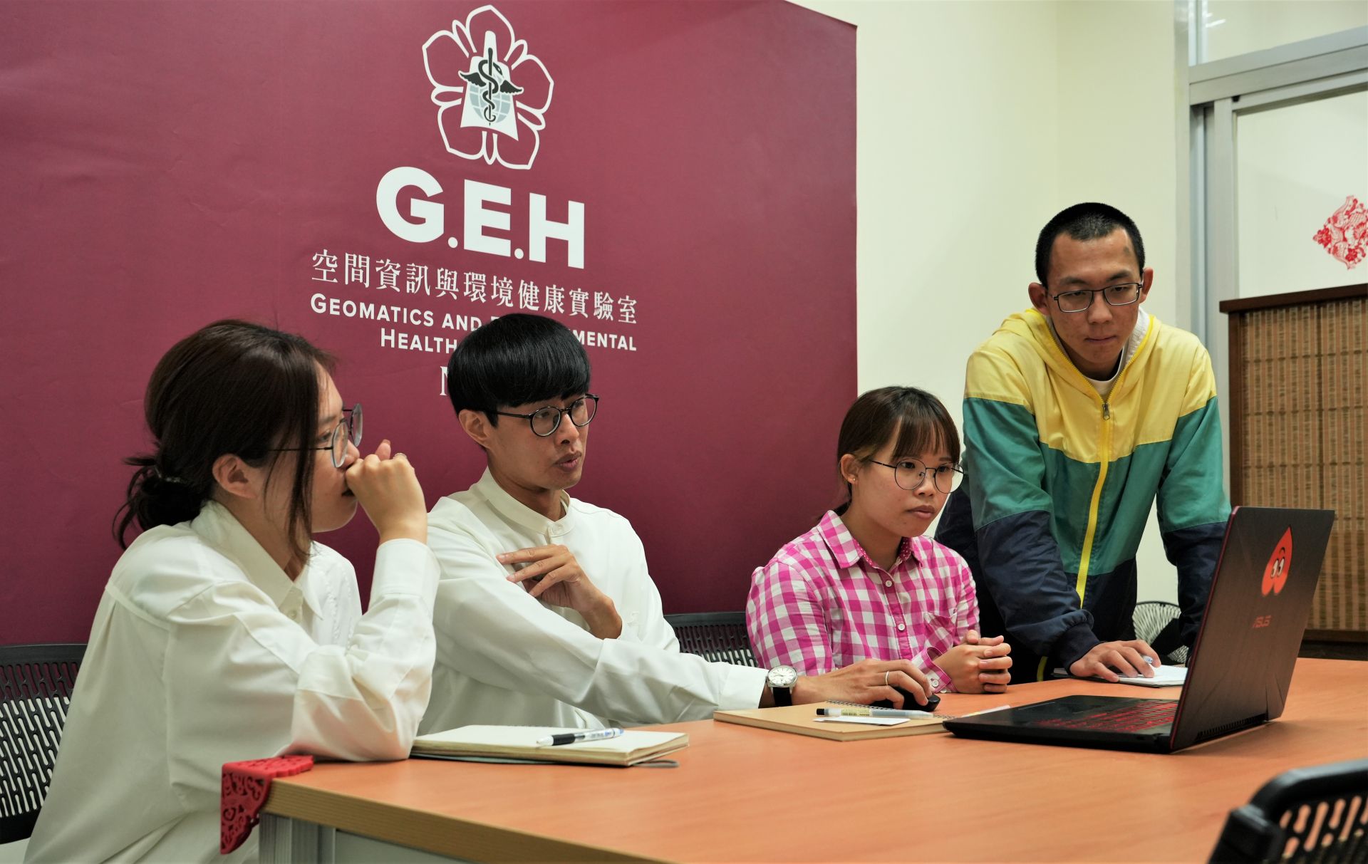
Chih-Da Wu's team solves the ozone puzzle through an "Ensemble Mixed Spatial Prediction Model"
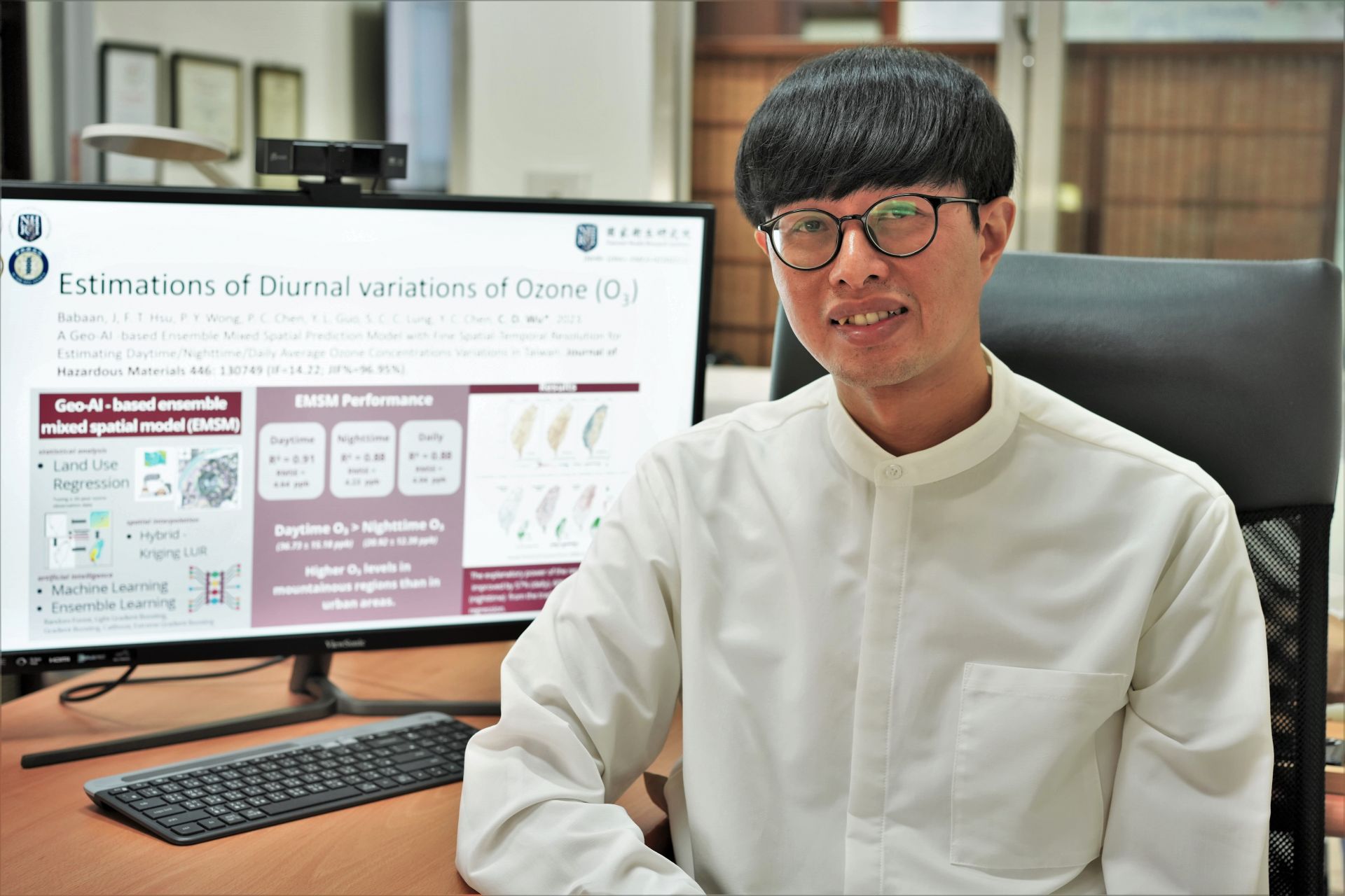
"Ensemble Mixed Spatial Prediction Model" Designed by Chih-Da Wu, an Associate Professor from the Department of Geomatics, NCKU, is listed in a Top International Journal
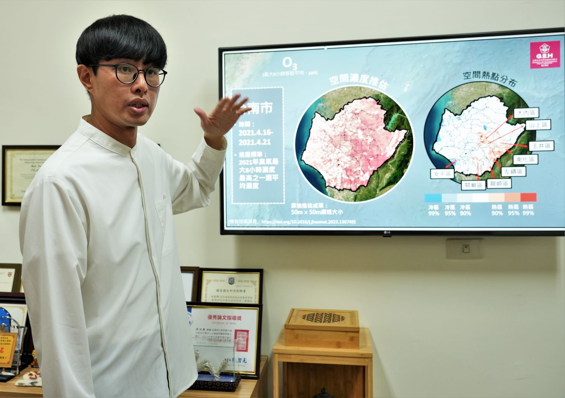
The accuracy of Chih-Da Wu's team's prediction of ozone concentration changes in various regions of Taiwan is as high as 90%.
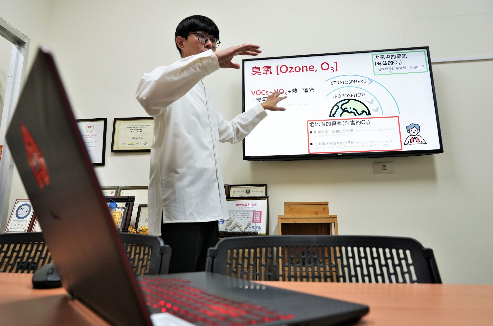
In recent years, the sources and negative effects of ozone emissions have been gaining attention, which has led to the research inspiration of Associate Professor Chih-Da Wu of the Department of Geomatics, NCKU.
SDG11Cultural Affairs Bureau and NCKU join forces, sign memorandum to boost cultural education cooperation.
View more
SDG11AI Encounters Confucius: Future Scenario Exploration in NCKU’s Interdisciplinary Design Thinking & Co-creation Program
View more